AMALFI: Autonomous Measurement Network for the Analysis of Liveable Cycling Infrastructure
22099
From 2023 to 2024
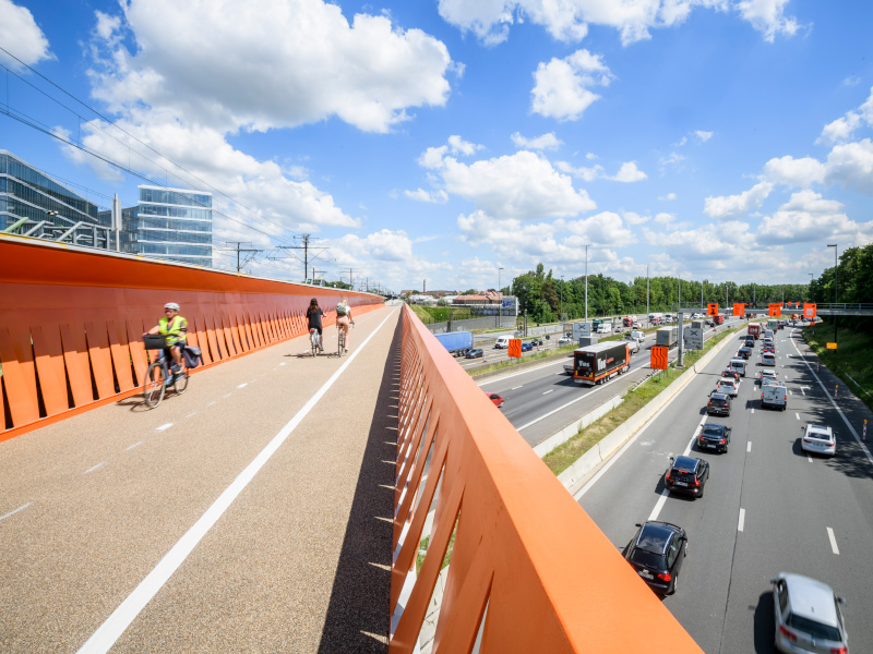
Foto: © Province of Vlaams-Brabant
TML mapped the use of the F3 cycle highway using Telraam sensors and the Traffic Scout simulation environment to improve the quality of cycling infrastructure. The project focused on developing a low-cost Telraam device for outdoor use and analysing cycling intensities, user profiles, and safety risks.
This project aimed to enable better management of high-quality cycling infrastructure by gaining a thorough understanding of its users. With AMALFI (Autonomous Measurement Network for the Analysis of Liveable Cycling Infrastructure), we developped a low-cost Telraam device that can work outdoors and linked it to various data sources and innovative modelling techniques (Traffic Scout) to map bicycle movements in detail. We wanted to identify and overcome all implementation risks: ease of installation, robustness, quality of the counts, resistance to the elements and vandalism, licensing elements for installations in the public domain, data retrieval, etc.
The project results include the following components:
- A network of Telraam sensors (both classic and new sensors for outdoor use) on and around the F3 bicycle highway.
- A calibrated bicycle model (Traffic Scout) for the F3 bicycle highway and the surrounding area.
- A concise report with an analysis of the functional use of the cycling infrastructure on and around the F3 cycle highway.
Installing the number of sensors was a simple indicator to monitor. We assumed at least 40 but ideally 60 locations for which good Telraam data will be collected.
We deliberately chose to develop one case (the F3 bicycle highway) in depth, so that we could cover all implementation risks in this pilot project and thus find out which analyses are most useful. This allowed us to improve the method before scaling it up to other mixed-use bicycle highways or infrastructure. We focused the methodology on providing insights into the following aspects:
- Intensities and speeds of cyclists, pedestrians, and cars on each road segment of the bicycle highway and the main access routes.
- Understanding the approach routes, origins, and destinations of the various user profiles of the bicycle highways.
- Profiling of users in hours and days, depending on use (recreational, commuting, etc.), speed and age (child, adult, and elderly).
- Identification of mixed-use infrastructure for safety risks, with emphasis on pedestrians and cyclists, cyclists and cars, and cyclists of different speeds.
TML mapped cycling intensities on the various access routes of the F3 bicycle highway. We extrapolated the count data to roads for which it was missing. For this, we used our data-driven, state-of-the-art simulation environment, namely Traffic Scout.
This project was made possible thanks to (among other things) the financial support of the Smart Region programme of the province of Flemish Brabant.